- Overview
- History of Matthiessen State Park
- Hours & Entry Fees
- Complete Trail Guide
- Waterfall Guide
- Best Time to Visit
- Other Activities
- Current Closures
- Facilities & Picnic Areas
- Video Preview
- Location & Parking
- Family, Dogs & Accessibility
- Nearby Attractions
- What Visitors Say
- Insider Tips & Common Mistakes
- FAQs
Overview
Matthiessen State Park sits in central LaSalle County, Illinois, about 95 miles west of Chicago and just a few miles south of Starved Rock State Park. Often called Starved Rock's quieter sibling, Matthiessen covers roughly 1,938 acres and is known for deeper, more rugged canyons, three named waterfalls, and noticeably smaller crowds than its famous neighbor.
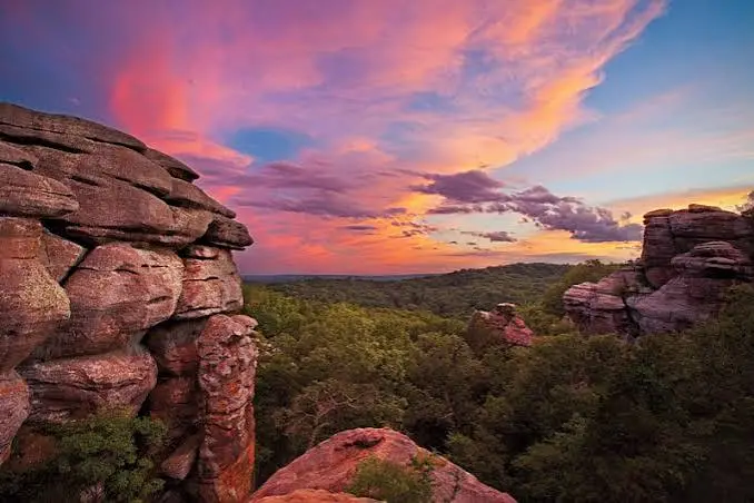
Where Starved Rock draws bigger numbers and more structured trails, Matthiessen offers a slightly more adventurous hiking experience, with stream crossings, narrow pathways, and steep stairs into two dramatic dells. It's a natural add-on for anyone already visiting Starved Rock, or a destination in its own right for hikers who want the same sandstone canyon scenery without the crowds.
History of Matthiessen State Park
The park is named for Frederick William Matthiessen, a prominent industrialist and philanthropist from nearby LaSalle, who purchased the land near the end of the 19th century and ran it as a privately owned park for years before it eventually became public land. That private, curated origin is part of why the park still feels a little more intimate and less commercialized than a typical state park.
Hours & Entry Fees
Matthiessen State Park is completely free to enter, with no admission or parking fee, same as neighboring Starved Rock. All parking lots and trails open at sunrise and close at sunset, and the park is open every day of the year unless otherwise noted for weather or maintenance.
Complete Trail Guide
The park has roughly 5 miles of well-marked, well-surfaced hiking trails, plus 9 miles of multi-use mountain bike and horseback riding trails and 6 miles of cross-country ski trails in winter.
| Trail Area | Difficulty | Highlights |
|---|---|---|
| Upper Dells / Bluff Tops | Easy | Novice-friendly paths along the canyon rim |
| Lower Dells | Moderate–Difficult | Narrow interior canyon paths, considered the park's crown jewel |
| Cascade Falls Trail | Moderate | Starts near the log fort in the Dells Area |
| Vermilion River Area Trails | Easy–Moderate | River views, birdwatching, sunflower field nearby |
| Mountain bike / horseback trails | Moderate | 9 miles, separate from hiking-only trails |
Hikers must stay on marked trails, since steep cliffs and deep canyons can be genuinely dangerous off-path, and bicycles, scooters, skates, and skateboards are not permitted in the Dells area.
Waterfall Guide
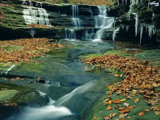
Matthiessen has three named waterfalls: Lake Falls, Cascade Falls, and Giants' Bathtub Falls. Like the falls at Starved Rock, these are seasonal and fed by rain and snowmelt, so a dry summer stretch can leave them reduced to a trickle or dry entirely.
Best Time to Visit
- Spring: Fullest waterfalls and the most dramatic canyon scenery.
- Summer: Sunflower fields bloom from mid-July through the first week of August near the Vermilion River Area.
- Fall: Cooler hiking weather and layered foliage across the dells.
- Winter: 6 miles of cross-country ski trails with weekend rentals available December through March.
Other Activities
Beyond hiking, the park supports biking, horseback riding, bank fishing, hunting, canoeing, kayaking, field archery, and even a radio-controlled model airplane field in the Vermilion River Area. Birdwatchers regularly spot hawks, owls, songbirds, and migrating waterfowl, especially around the Dells Area lakes.
Current Closures
As of mid-2026, several areas of the park have posted closures: the restroom building at the Matthiessen Dells parking lot is closed for repairs (with porta-potties available), the Lake Falls bridge and trail is closed to hiking traffic with a posted detour, and interior access to Lake Falls, Middle Falls, and Cascade Falls has been closed due to storm water and rising levels on the Vermilion River. Horseback trails and the campground are also closed, with a planned May 1 reopening depending on conditions. Always check the Illinois DNR park page for the latest status before you go.
Facilities & Picnic Areas
- Dells Area: Picnic tables, water fountains, playground equipment, a large parking lot, and a restored log fort kids love climbing on.
- Vermilion River Area: Additional picnic shelters, tables, grills, and drinking fountains.
- Playgrounds and picnic shelters are first-come, first-served.
- Alcohol is prohibited on all trails, and in picnic areas from January 1 through May 31.
Video Preview
Location & Parking
Matthiessen State Park is located at 2500 Illinois State Route 178, Oglesby, Illinois 61348, in central LaSalle County, about three miles east of Oglesby and four miles south of Utica, just south of Starved Rock State Park.
Family, Dogs & Accessibility
The Dells Area's playground and log fort make it a great spot for young kids and easy family hiking along the bluff tops, though the interior dell trails involve steep stairs, narrow paths, and stream crossings that are genuinely more rugged than Starved Rock's main routes. Dogs are allowed on leashes up to 10 feet but aren't permitted in buildings or swimming areas, and owners must clean up after pets. Visitors with mobility concerns should note that seeing the waterfalls up close typically requires descending roughly 150 steps, which can be difficult, especially on the way back up.
Nearby Attractions
Starved Rock State Park is just a few miles north and pairs naturally with a Matthiessen visit for a two-canyon day. The river town of Utica, with its shops and the LaSalle County Historical Museum, and Buffalo Rock State Park are also within a short drive, making this stretch of LaSalle County an easy multi-park day trip.
What Visitors Say
Visitors often describe feeling far from it all while descending into the canyon on the stairs and walkways near the rock formations.
Some visitors note that summer trips can miss the waterfalls entirely, since flow depends heavily on recent rain.
Many reviewers compare it favorably to Starved Rock, noting grander canyons and noticeably fewer crowds.
Families with young kids frequently mention the log fort and Dells playground as an easy, low-effort stop.
Insider Tips & Common Mistakes
- Arrive before 11 a.m. on weekends between May and October to beat the Dells parking lot closures.
- Wear sturdy shoes; the interior dell trails have rocky, uneven terrain and can get slippery near the falls.
- Check current closures before you go, since storm-related trail and waterfall access closures were active in mid-2026.
- Pair it with Starved Rock for a full day of canyon hiking, since the two parks sit just a few miles apart.
- Bring your own water; on-site facilities are limited compared to a fully staffed visitor center.
- Common mistake: expecting full waterfalls in a dry summer. Time your visit for spring or right after rainfall instead.
Frequently Asked Questions
Is there an entrance fee for Matthiessen State Park?
No, the park is free to enter with no admission or parking fee.
What are Matthiessen's hours?
Parking lots and trails open at sunrise and close at sunset, and the park is open every day of the year unless otherwise noted.
How far is Matthiessen from Starved Rock?
They're just a few miles apart in LaSalle County, making it easy to visit both parks in a single day.
Are dogs allowed at Matthiessen State Park?
Yes, dogs are allowed on leashes up to 10 feet, but they're not permitted in buildings or swimming areas.
Can you swim at Matthiessen State Park?
No, swimming is prohibited throughout the park. Streams and waterfalls are for viewing only.
What is the best time to see the waterfalls?
Spring or right after a rainstorm gives the fullest flow. In a dry summer, the falls can slow to a trickle or stop entirely.
Are there current trail closures at Matthiessen?
Yes, as of mid-2026 several areas including the Lake Falls trail, interior waterfall access, and the horseback trails and campground have posted closures. Check the Illinois DNR site before visiting.